 |
|
 |
|
BC:
June 1 - June 7 2005
Wednesday,
June
1.
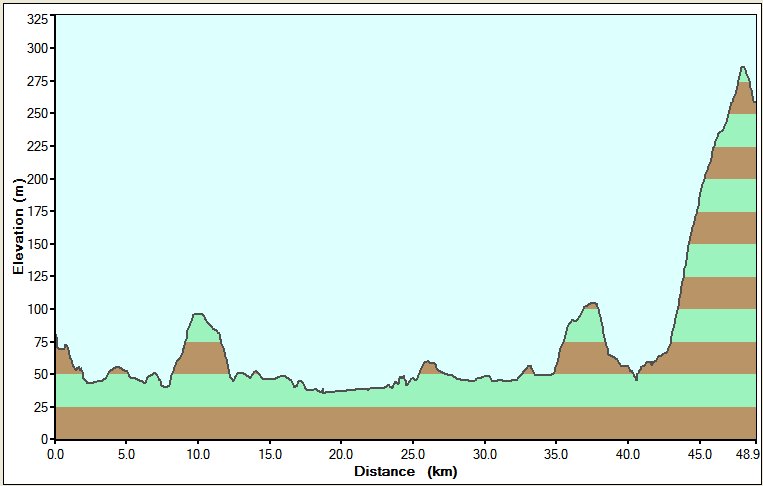
Bike log: 160 km, 800
m of vertical,
avg. speed 30.1 km/h.
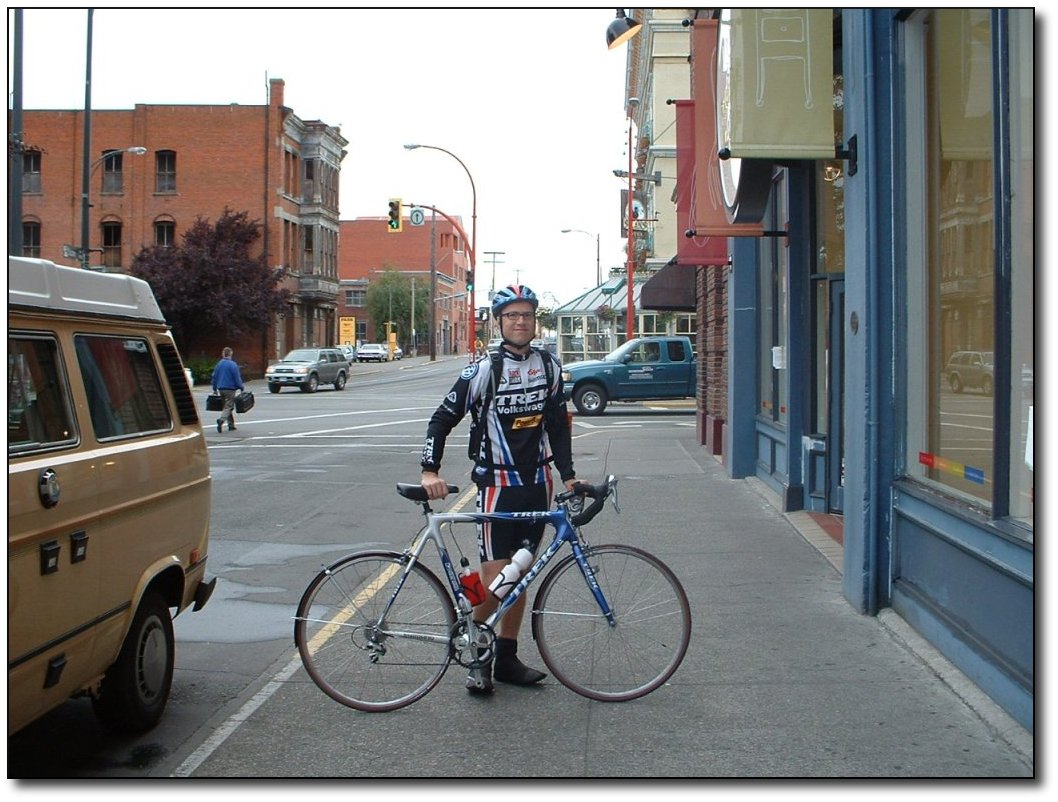
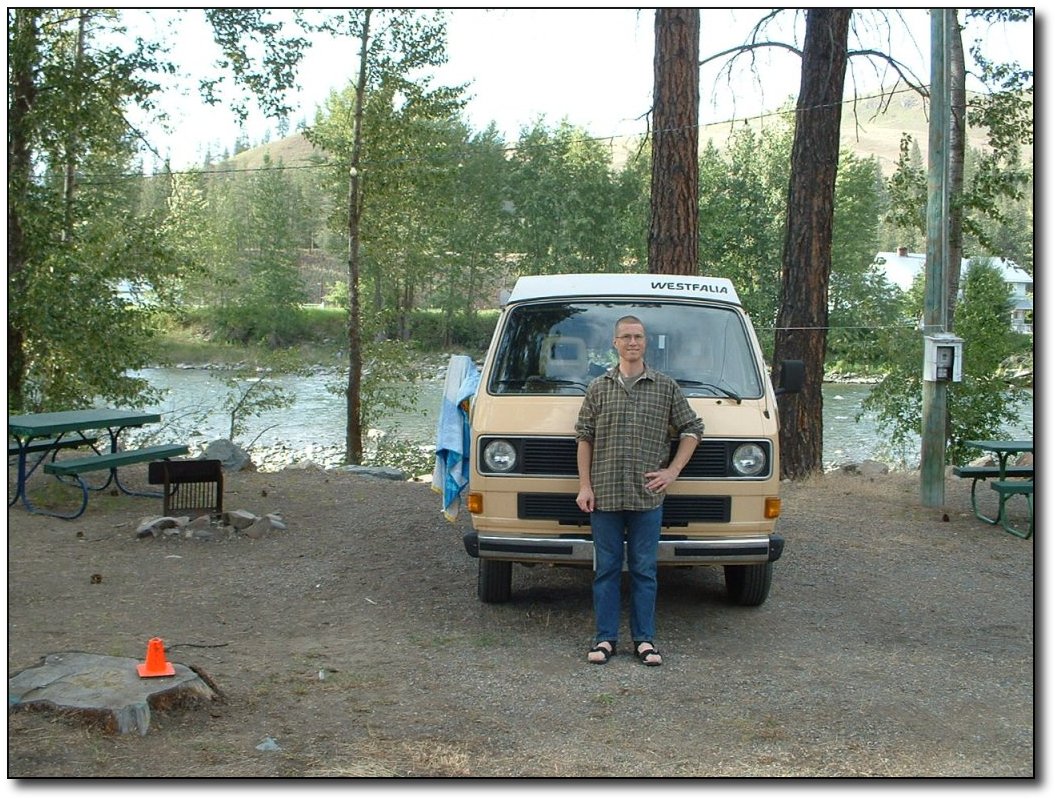
Me
before starting
Failure is impossible
with so much pro
equipment. I should be getting paid by Trek and Volkswagen for all
the free advertising.
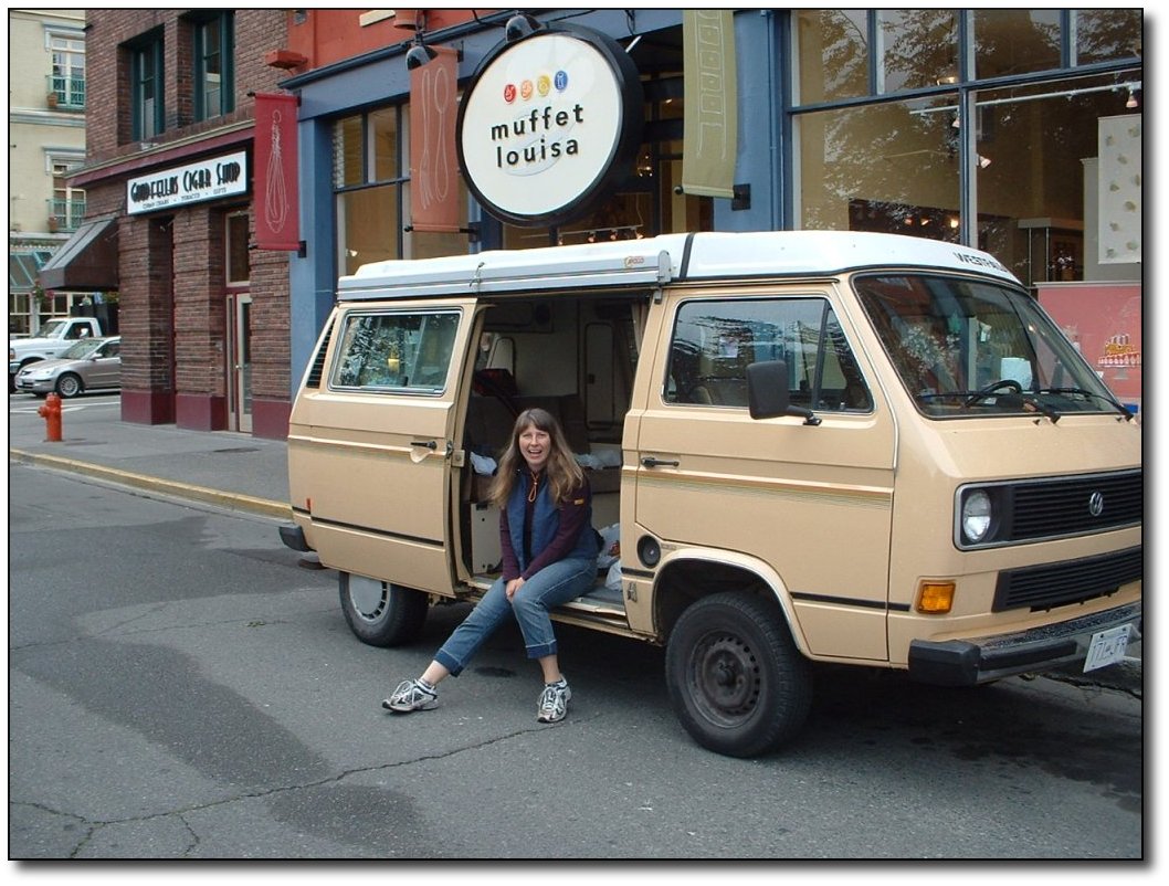
Leaving
Victoria
Ready or not, here we
go! Cheryl and the van, in front of my
place. We are so ready to go.
The lesson for today
was that you gotta
be prepared to go with whatever happens! We were trying to get the 9
AM ferry, but got a slightly late start and missed it. We were third
in line to not make it! I could have ridden on (I did manage to get
their just as they were loading), but Cheryl would have been stuck
waiting. So we got stuck at the Land's end cafe for 2 hours.
On
the ferry - Not so bad in a van!
It did give us the
chance to organize
the van a bit, which was good. Also, while we were waiting in line, a
reporter from the new VI came up and interviewed both of us on
camera. His first question was "How does this impact your travel
plans?" Good question!
The plan was to get
to Hope, which is
about 150 km from the other side of the ferry. Instead of getting
over there at around 10:45, we got in at 1. I had planned on a good 3
hour push (with frequent 2-3 min stops for food), then a 1 hr rest,
followed by another 2 hours, which would get us into Hope around 6 or
so. But it was not to be.
First of all, getting
through the lower
mainland was slower and more unpleasant than I had imagined. Traffic
was bad, too many stoplights, trucks passing within a few feet. Yuck!
It was like riding through about 75 km of Colwood (or Kenmore).
Cheryl was stopping every 20 km or so, and would feed me sandwiches
or granola bars. I ate about 6 peanut butter sandwiches!
Finally, past
Abbotsford, we got into
some nice open farmland. Beautiful countryside, with the mountains as
backdrop. The wind came up a bit from the east (bummer) but it sill
beat riding through traffic. Probably a taste of what is to come in
the prairies as it was very flat and there were farms all around.
We stopped at a
little vegetable store
to pick up some supplies for dinner, and when I came out, I was
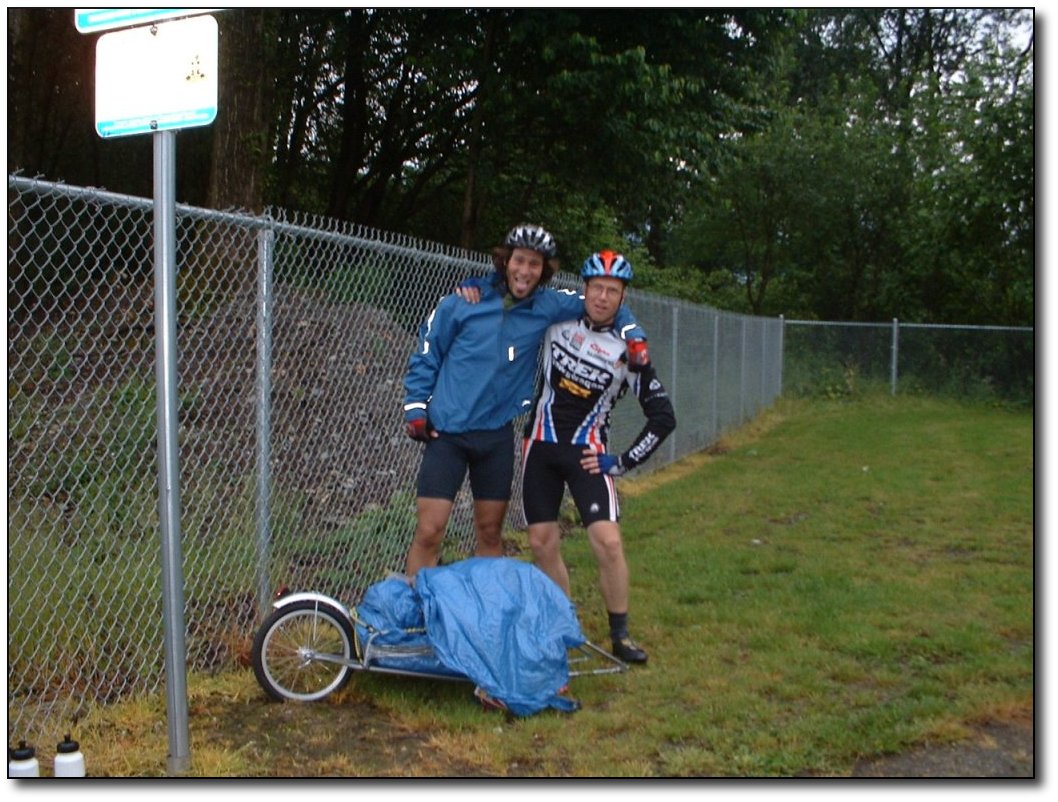
approached by another cyclist (Simon). I recognized him from the
ferry, plus I had passed him at one point on the road. He was pulling
a major load on a little trailer (probably about 50 pounds), but his
trailer tire was flat. He had tried to repair it but it blew again.
We were still about 10 km from Chilliwack, which put him in a pretty
awkward spot! We got to chatting, turns out he is from Quebec, and is
riding across Canada to raise money for Stroke and Heart Disease.
I suggested that we
throw his trailer
in the van and he & I could ride on to Chilliwack, where he
could
get his bike repaired. That worked out pretty well, the roads are
really flat so we made good time. We got into Chilliwack around 7PM
and drove/rode around a bit there looking for a place near the bike
store (which was closed) that he could camp. We left him in a little
park, gave him a bunch of water and swapped phone numbers. It was
great to be able to help him out! I hope to get a link to his website
sometime and will post it if I get a chance. He sure has a heavy load
to pull through the mountains!
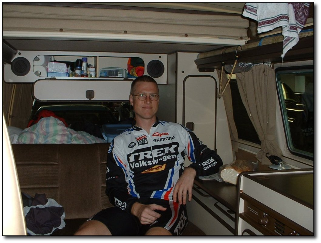
Chris
and Simon - towards the end of day 1
From there, I was
still hoping we could
make it to Hope, so I hopped back on the bike and hit the road again.
But, it started getting overcast, which in these parts mean it turns
dark! By 8PM it was pretty much too dark to ride (without setting up
lights, which I did not want to do) so we pulled off at Bridal Falls
and camped. The campsite here is really nice and had awesome blasting
hot showers which was a huge relief at the end of the day. We ended
up making dinner in the dark (another lesson learned - get off the
road with enough time to cook while it's light) and left the van in a
state of disarray til the morning while we crawled into bed about
11PM!
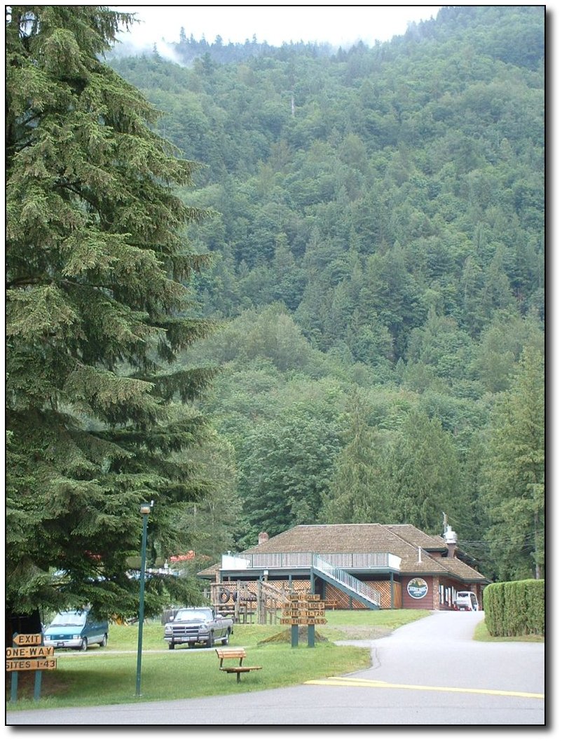
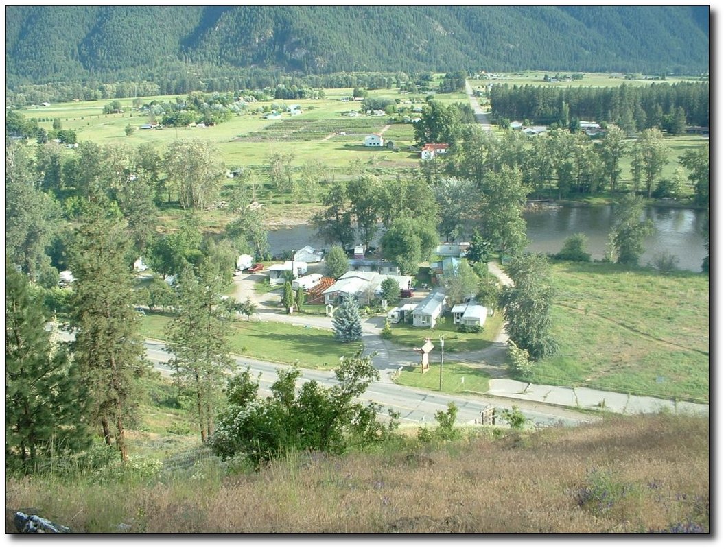
Campground
at Bridal Veil Falls
We are about 35 km
short of Hope, which
means the next day is going to be really tough, plus the late night
meant no early start. Oh well, it was still a great day, I am really
glad we were able to meet Simon and help out his trip.
So...we will take it
as it comes! It
all worked out great in the end.
|
|
 |
|
 |
|
|
|
|
|
|
|
|
Thursday, June 2
Bike Log: 49 km, 429m, average speed 27 km/h
June
2 - Bridal Falls to Hope
Not a hard day at all
(totaled about 49
km including a lot of mucking around). We got a really late start (we
did not get on the road until noon), and also had to stop in Hope to
pick up a few supplies. We started heading up the pass, but by then
it was nearly 4PM and we decided to stop at a campground near the
base of the pass. There are not a lot of camping options until after
you reach the summit (1200m), which I figured would be at least a 3
hour climb. To avoid a repeat of last night's cook in the dark, we
packed it in early and will get up early and make a good day
tomorrow.
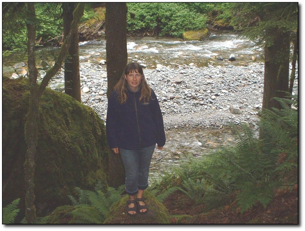
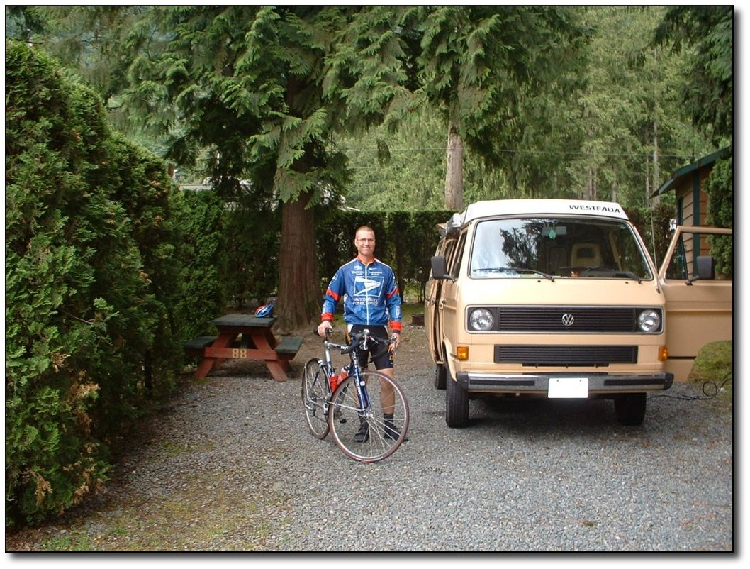
Cheryl
at Nicolum River (Hope)
This is a really
beautiful campground.
We are perched just up off a running stream (the Nicolum river). It
is a pretty cold stream - I know because that was where I bathed
today! There is so much moss and other plant life here, it makes you
wonder if it ever gets dry. It is also very gloomy weather. It has
been dark all day, almost like dusk. It has also been on and off
light rain for good parts of the day, making it difficult to get
properly suited up to ride, especially since it is also quite cool.
Tomorrow, at least I will be climbing uphill (for the first while
anyway) so I won't have to worry about getting cold!
We saw three hippies
today. They looked
genuine. We also saw them at the ferry terminal. They spotted the van
and asked us back at the ferries if we were going to "just the
other side of Vancouver." Today, I passed them on the highway
(they were walking), and 10 minutes or so later they walked in to the
campground. We were still trying to decide what we were going to do.
They asked if we were going to Princeton, but they're going on to
Nelson, probably from one of the gulf islands. Definitely genuine. As
2 of them went down to the white water stream to see if they could
"spear a fish" (more likely club one, since all they were
carrying were some walking sticks), we talked to the 3rd and gave him
3 granola bars.
We were finished
dinner and washed
dishes by 6:30. Should be an early night. It feels later because it's
so dark!
|
|
|
|
|
|
|
|
|
|
|
|
|
Friday,
June 3
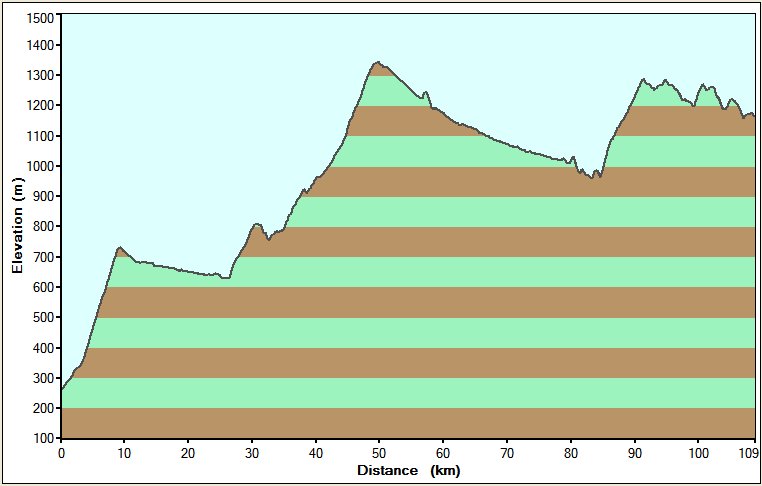
Bike log: 134km, 1900m of vertical, avg
speed 24.9 km/h

June
3 - Hope to Princeton
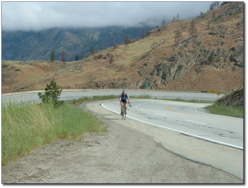
That was quite a day!
134km plus nearly
2 km of vertical. There were 2 pretty good passes. This is a photo of
me at the top of the 2nd pass. The first was a bit higher and
steeper.
We got a good start
to the day - on the
road before 8. Last night just as we were going to bed, another
cyclist rolled up to the campsite beside us. Another guy with a
massive bike trailer. I did not talk to him, but he had a little
Swiss flag on the back of his bike trailer. It was pretty late to be
getting in. As he was cooking dinner, I saw him light up a cigarette!
Insane! It made me feel kind of wimpy, seeing him with that huge
trailer, and still able to puff a cigarette. He was also on the road
before us this morning, around 7. However, I felt quite a bit better
when I passed him on the first hill - walking his bike. I chatted
very briefly with him, he seemed to be OK with lugging his bike up. I
told him it was a long way...but he was Swiss so he already knew. I
wonder how far he made it today, those were some very long hills. I
also wonder how much longer he will be pulling all that weight.
The terrain is not
too steep yet. Just
long. I am glad I have been training on the really steep stuff around
Victoria (Mt. Doug, Dunsmuir, Munn Rd) as it makes these hills not
seem so bad. I have not had to use less than 3rd gear yet. However, I
am pretty sure that will change before too long. I find alternating
between sitting and standing helps to break things up too, use
different muscles.
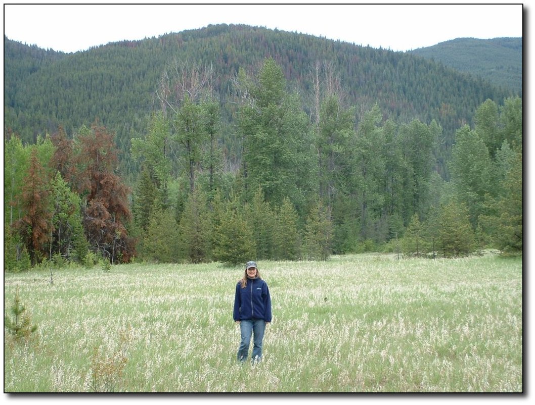
Meadow
on the Hope-Princeton
Here's Cheryl at the
top of Sunday
Summit. Beautiful terrain, all the way up, alternating from meadows,
to forest, to streams, to all of the above!
Princeton
Campground
I had to contend with
something I had
not expected at all - cold. It was probably about 12 degrees C
leaving this morning, and it got colder and colder the further up I
got. The problem is that you sweat going up the hill, and as soon as
you hit the summit you go fast and chill off. Coming up it was also
very damp (some light rain in places). I changed clothes at the top
of the first pass and had my normal winter riding clothes on.
Finally, coming down the last 15 km into Princeton, I could feel it
get dry as the forest changed away from a rainforest, and the
temperature picked up, so my clothes from the first day have finally
dried out. Princeton was sunny and warm (relatively speaking). We got
a great campsite right on the river, showers were free. Dinner was
pizza - delivered to our campsite! I was really hungry and didn't
feel like heading back to town to pick up groceries.
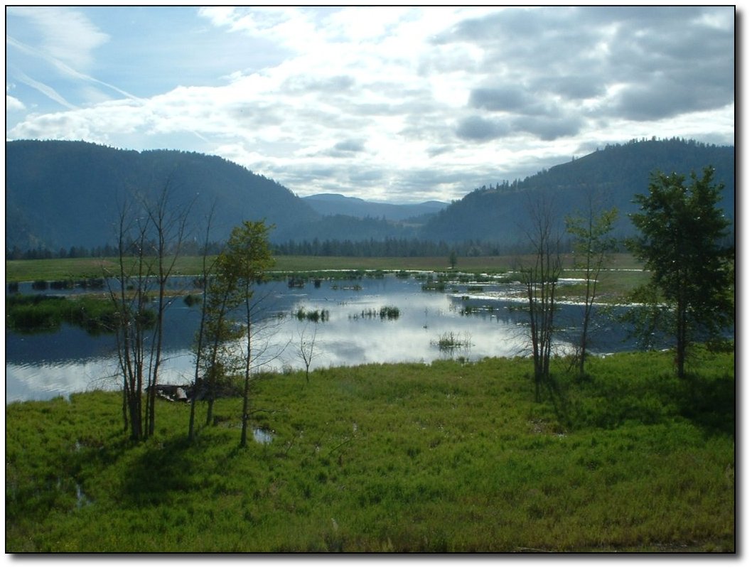
Pretty
Scenery near Princeton Campground
It was a great day
for wildlife
spotting. I saw a moose, a black bear, several deer, gophers, and at
least 8 slugs. Or else the same slug 8 times, he just kept passing
me. The moose ran across the road about 30m in front of me, then
stopped on the other side and looked back. I kept going, but I don't
think he knew what to make of me. The bear was on the other side of
the road (4 lanes at that point, thankfully!), kind of sitting in the
ditch. There were a couple of cars stopped over by him, so I didn't
see him til I was pretty much even. As I passed, he kind of looked
over. I was on an uphill, so I am glad he did not decide to
investigate. However, if he had, I would have done the world's
fastest U-turn and headed downhill!
|
|
|
|
|
|
|
|
|
|
|
|
Saturday,
June
4
June
4 - Princeton to Osoyoos
It should have been an easy day but a
really strong headwind came up about 40km into the ride, and kept
building for pretty much the whole day. For a lot of the last part, I
was using the same gears as I did climbing up the hill out of Hope.
The wind is very challenging, probably worse than hills. But tomorrow
is a rest day!
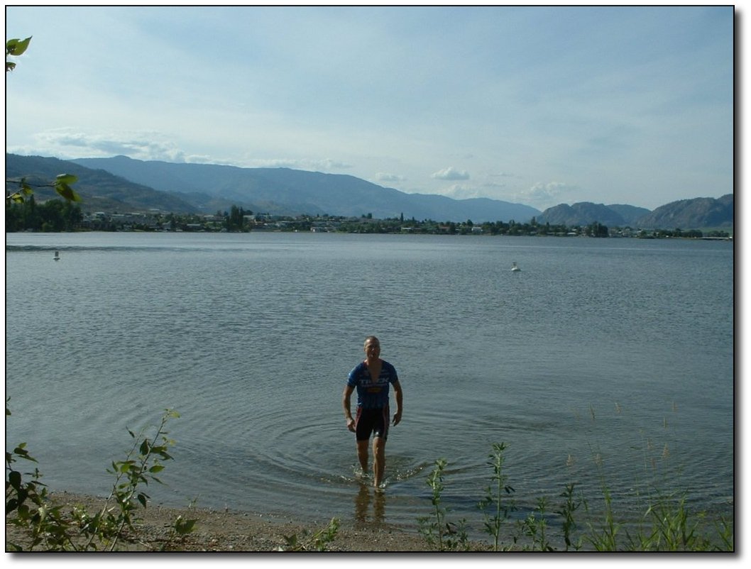
We were planning on staying at Haynes
point provincial campground, but it was full by the time we got here.
I guess being the weekend that is not too surprising. We decided to
stay at a cheap motel for the night rather than drive around to the
various other campgrounds, since it was nearly 5:30 by the time we
got here. I did go swimming in the lake though. Still pretty cold, I
would not have done it except right after getting off the bike.
Bromley
Rock Provincial Park
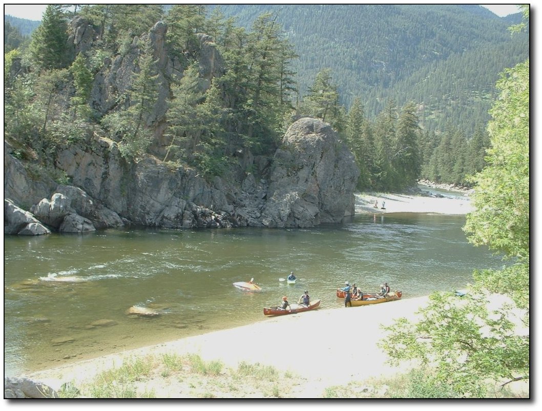
We wound along the Similkameen River for most of the day
- it
is a very pretty river. Lots of good places to stop and swim,
like this provinicial park, but we did not do so today. The
water
was pretty chilly still, and we were trying to make some decent time to
meet up with Cheryl's dad.
One
of the strange things in Hedley
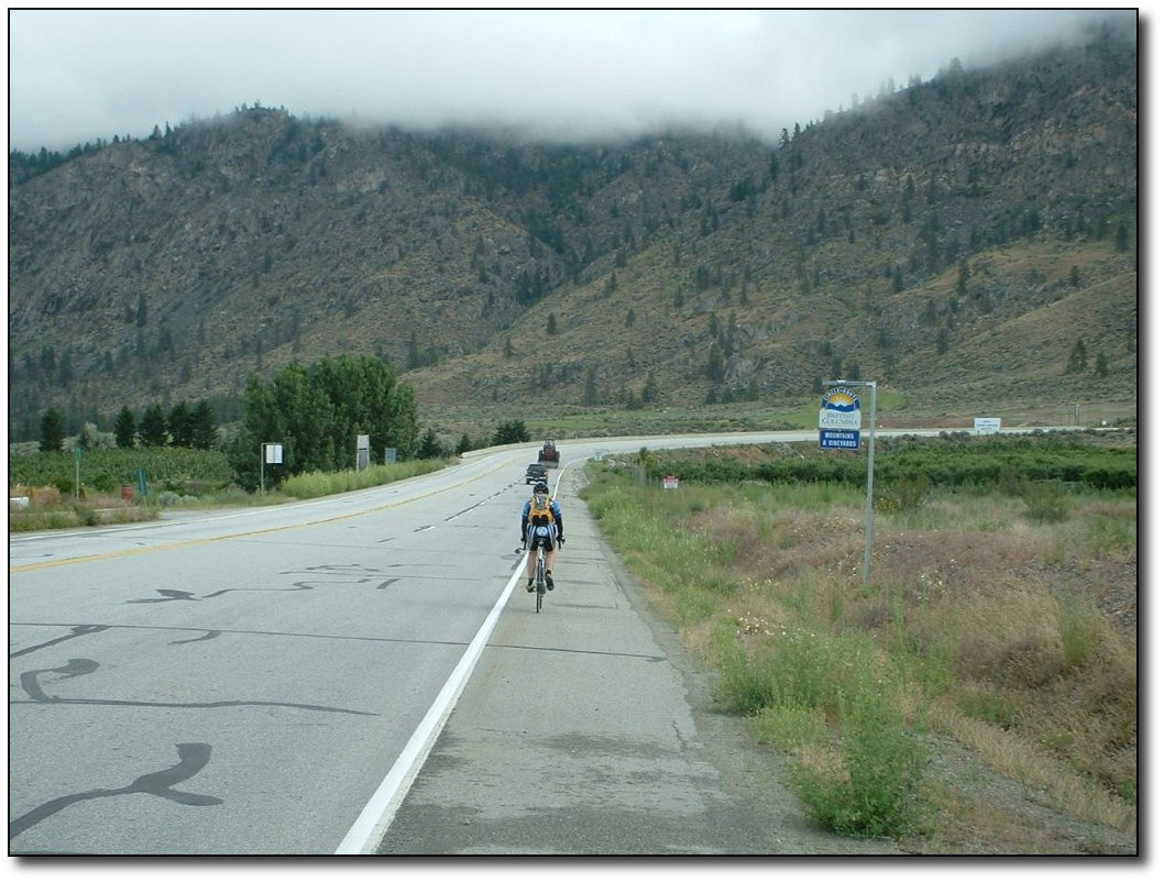
We passed through the strange town of Hedley today.
A
few people still live there, but it is not as bustling as it was back
when there was a mine still operating up in the mountain.
Interesting spot to stop and look around though, it is very
unique!
Just past Hedley, my bike speedometer stopped working. I
had
to do some troubleshooting, and all I had was a
sock and some oil. It is, in my opinion, poorly designed as
it
requires 3 batteries and is not sufficiently weather-proofed.
(Sigma Sport, by the
way, if you want my advise avoid them). But some cleaning
with
the sock and the oil turned out to be just
the ticket to get it going again.
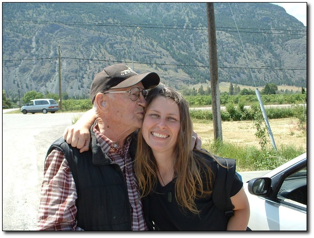
The
Cawstons in Cawston
Cheryl hooked up with
her dad in
Cawston BC (the town is named after Cheryl's great grandfather). I
just missed seeing them by about 5 minutes, too bad it would have
been fun to see the Cawstons in Cawston. But hopefully we
will see
them tomorrow.
Osoyoos is a favourite town of Cheryl's
and mine, so we know a few of the local restaurants and attractions.
We are going to go to dinner tonight at one of our old favourites,
and since I am not riding tomorrow I'll have the first beer since
leaving Victoria. By the way, I hope Swan's is getting through their
first weekend with me away...I am relying on some friends back in
Victoria to do their part and make sure they stay open.
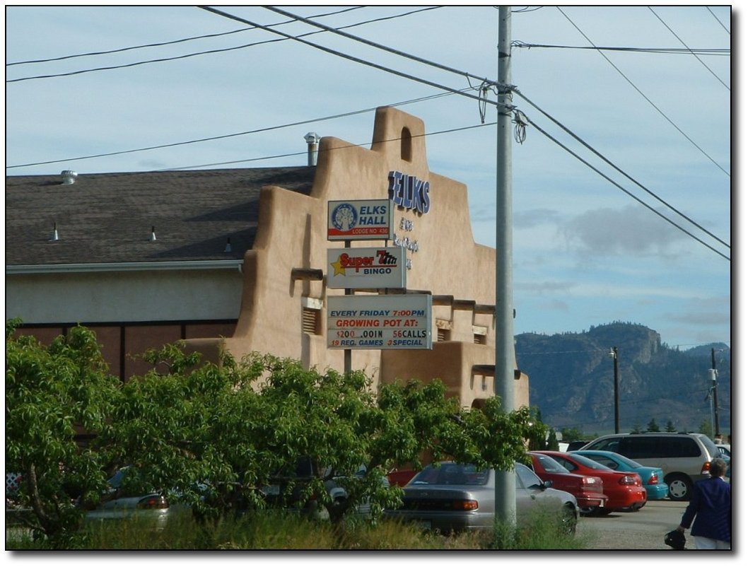
You
call it bingo, I call it
bong-o
Osoyoos is a
happening town, very
liberal with the laws. Or else the Elks are in leagues with the motor
cycle gangs who control the police! |
|
|
|
|
|
|
|
|
|
|
|
Monday,
June 6
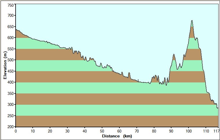
Bike log - 133.5km,
1673m of vertical,
average speed 25.4 km/h
June
6 - Osoyoos to Grand
Forks
Got a pretty early
start to the day -
on the road by 8. We're getting more organized now, I'm sure in a
while we'll be able to get on the road pretty quick. It rained and
blew pretty hard all night, but by 6 AM it was dry and still. Still
quite cool (about 13C), but that was just fine because the first
thing today was Anarchist pass - about 800m of vertical in about
30km. As it turned out, it was not too bad. The road grades are not
too steep as it is well traveled by trucks. The shoulder was good,
and most of the drivers are pretty considerate. Most.
Climbing
Hills
I came up with my
three rules for
climbing long hills:
1)
Don't look up.
Look about 20-30 feet
ahead, watching for rocks and obstacles. If you look up, you will get
discouraged.
2)
Keep the revs up.
Also known as "go
easy early", as in shift as soon as you start to feel your revs
decrease. You want to avoid the burn in the legs, so keeping the revs
high helps to do this. Hey, it works for Lance!
3)
Eat and drink
defensively. Don't
wait until you feel thirsty or hungry, just constantly eat and drink.
Of course, going up
Anarchist pass, I
had to abandon all the rules so I could appear more as a local.
The view is definitely worth the effort:
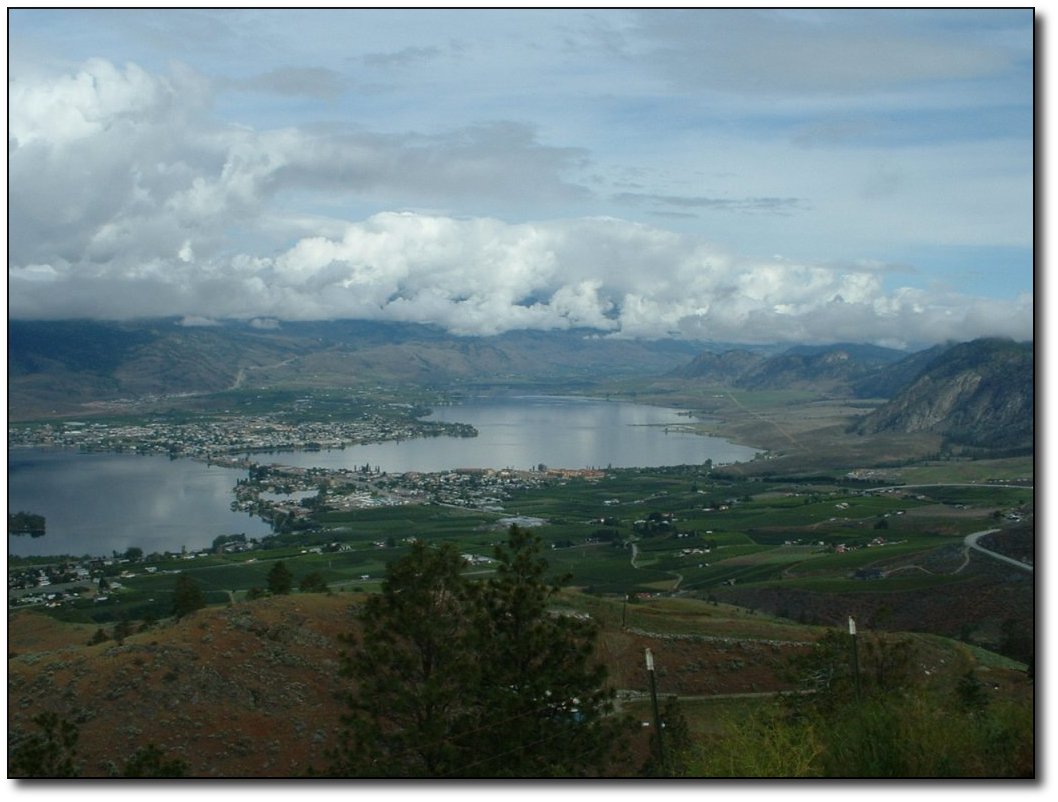
The
climb out of Osoyoos
About 2/3 of the way up there was a fantastic viewpoint that gave a
great view looking both North (as shown) and South along the Okanagon
Valley. This is sure a unique place!
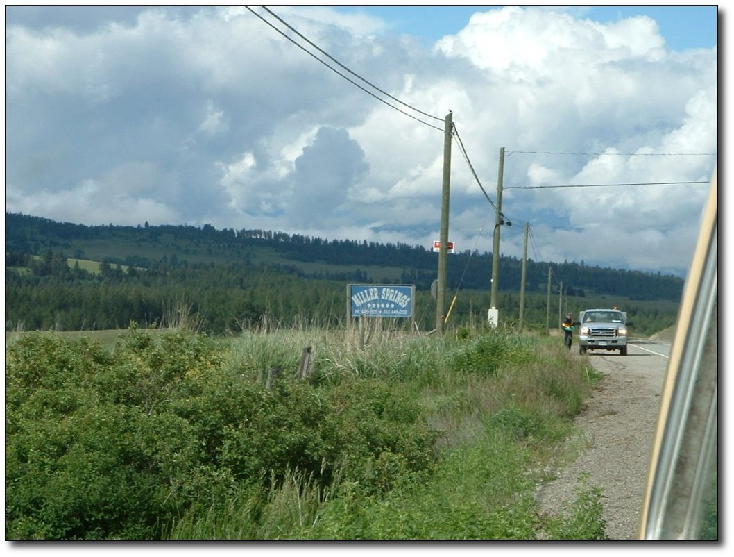
Miller
from a spring!
We found the place
where Miller beer
comes from - Miller Springs. It just comes out of the ground. Cheryl
got a great photo of it. There were some guys spraying preservatives
or something onto the fields, it just trickles down into the Miller
table and gets absorbed into the beer. We got a bottle of it, it is
very light but refreshing. I put it in my Camelback.
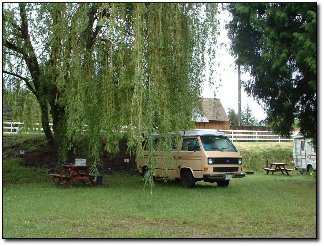
Campground
in Grand Forks
The terrain here is
much different that
the Okanagon valley - more trees, less dry. Still quite beautiful
though.
We were camped right
on the riverbank,
but it was really raging. I guess it settles down a bit in the summer
so you can swim in it, but it was sure a torrent when we were there.
|
|
|
|
|
|
|
|
|
|
|
|
Tuesday, June 7
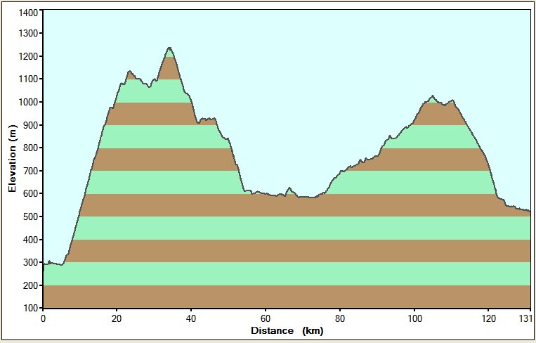
Bike log: 89.5km,
1230m of vertical,
average speed 22.3 km/h
June
7 - Grand Forks to
Castlegar
Not a very long day
in terms of mileage
but this was the most challenging day yet. We had rain the entire
day. The hill between these two towns is pretty big - about 1100m in
one big stretch. In places it is reasonably steep (about the same as
the Malahat), and you never get a rest until the summit. The rain
made it really quite unpleasant!
My rain clothes are
waterproof -
meaning they keep you nice and dry for a ride of low exertion, but
climbing up the hill, you get soaked from the inside since it is not
low exertion. On top of that, it kept getting colder and colder as I
got up. I would guess it was below 5C at the summit. Apparently it
was snowing in Fernie (still a ways ahead). It was OK when moving but
as soon as I stopped it was cold!
We had hoped to get
through to Nelson,
but given all this we stopped at Castlegar, which was just a 30km
coast down from the summit. Kind of disappointing to pull up 40km,
since I didn't feel too tired yet and it is supposed to be not too
bad of a ride, but given how lousy the weather was, it was a good
idea.
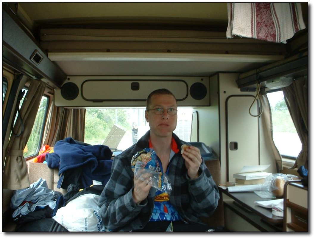
My
new hobby is eating
As we are settling in
to more of a
routine, Cheryl is making longer drives before stopping. They average
about 30km now, but could be as high as 45. While she is waiting, she
usually goes for walks through meadows or forests or the town. We
each have a Garmin GPS device with a built in walkie talkie. These
have worked out really well, even better than I hoped. When we leave
a spot, we pick a town, park, or approximate location (like a
summit), and say we will meet there. When I get close, I can beep
Cheryl, and my Garmin will send my current GPS coordinate to her. She
buzzes me back, and I get her coordinates back. There is a small LCD
display, and she shows up as a little icon on my map! Very
convenient. The detail in the unit is really high - supposedly every
street in Canada is here (although I have to download them from my
computer, since the unit can only store about 1 province worth at a
time). It also shows points of interest, parks, restaurants and
shopping (in major centres only). They can communicate from 3 -5km,
normal walkie talkie range, which is perfect for what we are doing.
It is great because it means Cheryl is not stuck waiting at the van
for me. If I arrive & she is out for a stroll, I have a key to
the van and can get in and start eating!
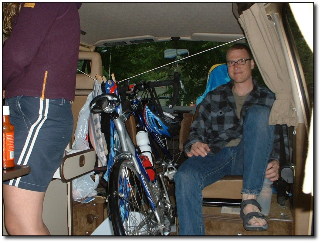
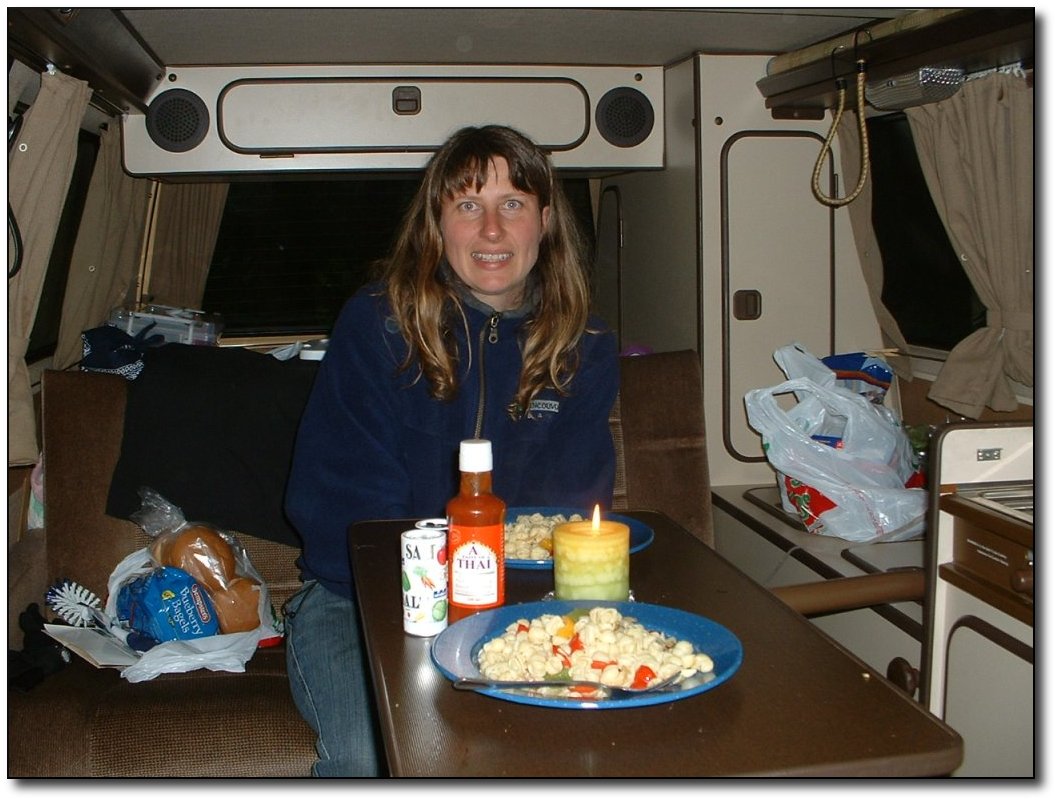
Dry
inside the van
Possibly the worst
part about riding in
the rain is that your bike gets completely coated in muck. This
highway seemed really dirty, I think because there is still all the
sand on the shoulder from the winter. I spent over an hour tonight
cleaning my bike, and it is still not great. I am going to have to
pick up some more rags! However, we are pretty happy with the space
we've got inside the van, where it's dry. I can even bring the bike
in and there is room for me to sit and Cheryl to make dinner!
|
|
|
|
|
|